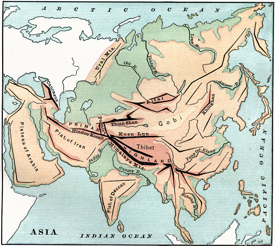
Description: An orographic map of Asia from 1885 showing the major mountain systems, plateaus, and plains, rivers, lakes, and coastal features of the region. This map is color-coded to show general elevations, with green representing lowlands and plains, and buff tints representing highlands, plateaus, and mountain regions. Mountain ranges are shown with heavy black lines, and include the Ural Mountains, Caucasus, Altai, Khinghan, Thian Shan, Hindoo Koosh, and the Himalaya Mountains. The plateaus of Arabia, Iran, and Deccan are shown, as well as the primary highlands of Pamir and Thibet (Tibet) and the Gobi basin. The major rivers shown are the Obi, Yenisei, Lena, Amoor, Yang-tse-Kiang, Mekong, Ganges, and Indus.
Place Names: A Complete Map of Asia, Caucasus, �Ural Mountains, �Hindoo Koosh, �Himalaya Mountains, �Kuen Lun, �Thian Shan, �Altai, �Khingha
ISO Topic Categories: elevation,
inlandWaters,
oceans
Keywords: Mountain Ranges of Asia, physical, kOrographic, physical features,
topographical, elevation,
inlandWaters,
oceans, Unknown, 1885
Source: M. F. Maury, Physical Geography (New York, NY: University Publishing Company, 1885) 35
Map Credit: Courtesy the private collection of Roy Winkelman |
|