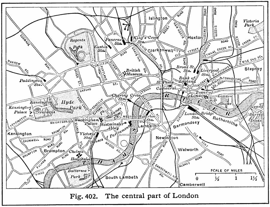
Description: A map of the central part of London in 1916. This map shows major roads, railways and stations, the Thames River, bridges, and landmarks such as Buckingham Palace, Westminster Abby, Hyde Park, Kensington Palace, Tower of London, Regents Park, St. Pauls Cathedral, and the British Museum.
Place Names: United Kingdom, London, �Hoxton, �Newingto
ISO Topic Categories: location,
oceans,
inlandWaters,
transportation
Keywords: Central London, physical, �political, �transportation, physical features, local jurisdictions, railroads,
roads, location,
oceans,
inlandWaters,
transportation, Unknown, 1916
Source: Albert Perry Brigham & Charles T. McFarlane, Essentials of Geography (New York, NY: American Book Company, 1916) 283
Map Credit: Courtesy the private collection of Roy Winkelman |
|