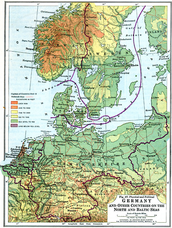
Description: A physical and political map of Germany and other countries on the North and Baltic seas in 1916, including Denmark, Netherlands, Belgium, and portions of Norway, Sweden, Finland, and Russia. The map shows the boundaries of the German Empire at that time, and portions of Poland, Austria–Hungary, Switzerland, and France. Capital cities, major cities, ports, and towns are shown, as well as railroads, canals, rivers, mountain systems, and color–coded elevations between sea level and elevations over 5000 feet. Lands below sea level are also shown.
Place Names: Western and Central Europe, France, �Germany, �Denmark, �Norway, �Sweden, �Polan
ISO Topic Categories: boundaries,
oceans,
location,
inlandWaters,
transportation
Keywords: Germany and other Countries on the North and Baltic Seas, political, �physical, �transportation, physical features, country borders, railroads, boundaries,
oceans,
location,
inlandWaters,
transportation, Unknown, 1916
Source: Albert Perry Brigham & Charles T. McFarlane, Essentials of Geography (New York, NY: American Book Company, 1916) 286
Map Credit: Courtesy the private collection of Roy Winkelman |
|