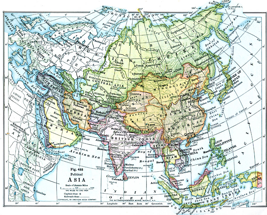
Description: A map of Asia from 1916 showing country boundaries at the time, major cities, railroads, rivers, lakes, terrain, and coastal features. The map indicates foreign possessions in the region with British India (which included Myanmar or Burma), French Indochina, and shows the Philippines as a possession of the United States. The map shows the extent of the Russian Empire and Turkish Ottoman Empire in Asia, and the territories of the Empire of Japan and the Chinese Republic at the time. The Chinese Republic is shown to include China proper, Tibet, Sinkiang, Mongolia, and Manchuria.
Place Names: A Complete Map of Asia, China, �India, �Thailand, �Russia, �Phillipines, �Mongolia, �Japan, �Indonesi
ISO Topic Categories: boundaries,
location,
oceans,
inlandWaters
Keywords: Asia, physical, �political, physical features, country borders, boundaries,
location,
oceans,
inlandWaters, Unknown, 1916
Source: Albert Perry Brigham & Charles T. McFarlane, Essentials of Geography (New York, NY: American Book Company, 1916) 334
Map Credit: Courtesy the private collection of Roy Winkelman |
|