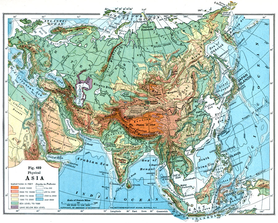
Description: A map from 1916 of Asia, showing physical features and general elevations. This map uses color-contours to show land elevations ranging from below sea level around the Caspian Sea to over 15000 feet, and water depths given in fathoms. The light blue tints indicate the submerged continental plateau of the region. This map shows mountain systems, plateaus, plains, steppes, deserts, major river systems, lakes, coastal features, and islands. The Great Wall of China is shown.
Place Names: A Complete Map of Asia, Japan, �China, �India, �Indonesia, �Kazakhstan, �Mongolia, �Pakistan, �Phillipines, �Russia, �Thailan
ISO Topic Categories: location,
inlandWaters,
oceans,
elevation
Keywords: Physical Asia, physical, �political, physical features, country borders, location,
inlandWaters,
oceans,
elevation, Unknown, 1916
Source: Albert Perry Brigham & Charles T. McFarlane, Essentials of Geography (New York, NY: American Book Company, 1916) 336
Map Credit: Courtesy the private collection of Roy Winkelman |
|