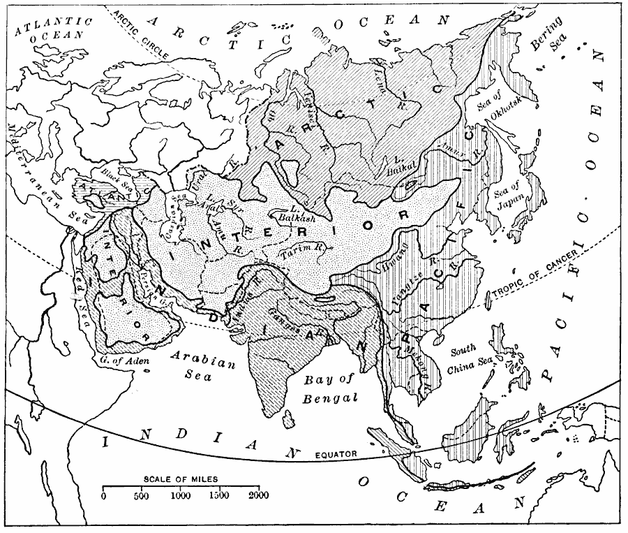
Description: A map from 1916 showing the various drainage basins across the Asian region. This map is keyed to show watersheds draining to the Bering Sea, Sea of Okhotsk, Sea of Japan, South China Sea, and Pacific Ocean, watersheds draining to the Red Sea, Persian Gulf, Arabian Sea, Bay of Bengal, and Indian Ocean, watersheds to the Arctic Ocean, and interior basins that do not drain to the sea. Major rivers and lakes are shown.
Place Names: A Complete Map of Asia, China, �India, �Japan, �Indonesia, �Kazakhstan, �Mongolia, �Pakistan, �Phillipines, �Russia, �Thailan
ISO Topic Categories: inlandWaters,
location,
oceans,
climatologyMeteorologyAtmosphere
Keywords: Drainage Basins of Asia, hydrological, �physical, kHydrologic, physical features, drainage basins, inlandWaters,
location,
oceans,
climatologyMeteorologyAtmosphere, Unknown, 1916
Source: Albert Perry Brigham & Charles T. McFarlane, Essentials of Geography (New York, NY: American Book Company, 1916) 338
Map Credit: Courtesy the private collection of Roy Winkelman |
|