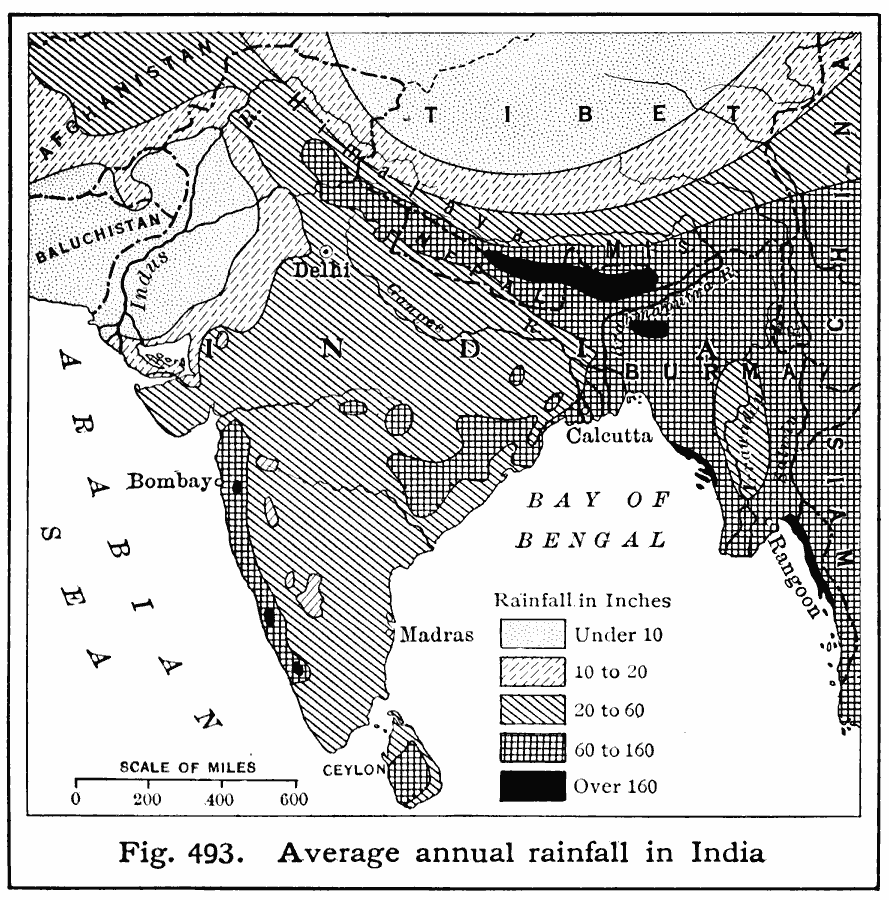
Description: A map from 1916 of India, showing the mean annual rainfall distribution in the region, measured in inches, and keyed to show regions where rainfall ranges from under 10 inches over the year to over 160 inches. The rainfall of southern Asia is brought chiefly by the summer monsoons.
Place Names: India , Madras, �Bombay, �Delh
ISO Topic Categories: oceans,
location,
inlandWaters,
climatologyMeteorologyAtmosphere
Keywords: Rainfall in India, physical, �meteorological, kClimate, physical features, rainfall, oceans,
location,
inlandWaters,
climatologyMeteorologyAtmosphere, Unknown, 1916
Source: Albert Perry Brigham & Charles T. McFarlane, Essentials of Geography (New York, NY: American Book Company, 1916) 339
Map Credit: Courtesy the private collection of Roy Winkelman |
|