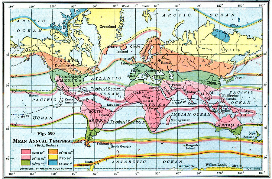
Description: A map from 1916 showing the mean annual temperatures of the world. This map is color–coded to show areas (land) and isotherms (oceans) ranging from an annual average temperature below 0° to over 80° Fahrenheit. The heat equator is shown.
Place Names: A Complete Map of Globes and Multi-continent, Antarctica, �Africa, �Asia, �Australia, �North America, �Europe, �South Americ
ISO Topic Categories: inlandWaters,
location,
oceans,
climatologyMeteorologyAtmosphere
Keywords: Mean Annual Temperatures, physical, �meteorological, kClimate, physical features, temperature, inlandWaters,
location,
oceans,
climatologyMeteorologyAtmosphere, Unknown, 1916
Source: Albert Perry Brigham & Charles T. McFarlane, Essentials of Geography (New York, NY: American Book Company, 1916) 400
Map Credit: Courtesy the private collection of Roy Winkelman |
|