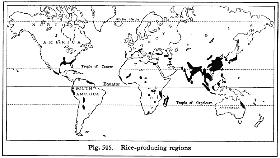
Description: A world map from 1916 showing the principal rice–producing regions of the world at the time. Based on five–year averages; "WorldŐs annual production, 155,000,000,000 pounds. Leading rice–growing countries, with percentage of world crop: India (46%), China (three provinces – 30%), Japanese Empire (15%). The United States produces less than one percent of the world total, although the production has considerably increased in recent years. Leading rice–exporting countries, with percentages of the worldŐs export of rice: India (42%), French Indo–China (18%), Siam (15%). Leading rice–growing states in the United States: Louisiana, Texas, Arkansas, California."
Place Names: A Complete Map of Globes and Multi-continent, Africa, �Antarctica, �Asia, �Australia, �Europe, �South America, �North Americ
ISO Topic Categories: farming,
oceans,
location
Keywords: Rice Production, statistical, kAgriculture, agriculture, farming,
oceans,
location, Unknown, 1916
Source: Albert Perry Brigham & Charles T. McFarlane, Essentials of Geography (New York, NY: American Book Company, 1916) 404
Map Credit: Courtesy the private collection of Roy Winkelman |
|