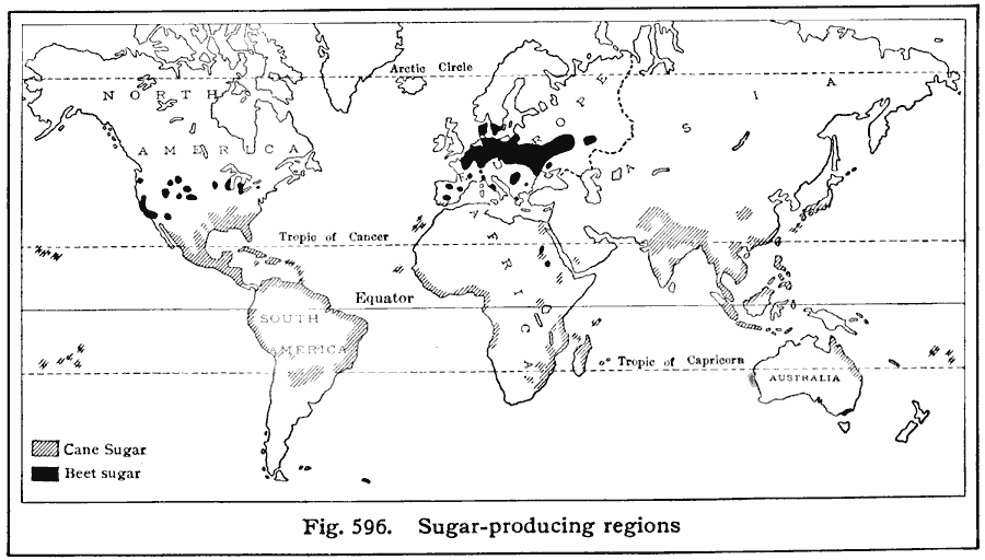
Description: A world map from 1916 showing the principal sugar-producing regions of the world at the time. This map shows regions of cane sugar with hatchures, and beet sugar in black. Sugar production is based on five-year averages; "WorldŐs annual crop, Cane (11,600,000 tons), Beet (8,800,000 tons). Leading cane-sugar countries, with percentages of the worldŐs cane-sugar crop: Cuba (29%), India (26%), U.S. and dependencies (15%), Java (14%). Leading beet-sugar countries are Germany, France, Russia, Poland, Czechoslovakia, and Belgium, for which recent statistics are not available because of the World War. The crop of cane sugar in the main body of the United States, of which Louisiana produces the greater part, averages nearly 300,000 tons a year. This is about 2 ½% of the worldŐs total. The leading beet-sugar states, with percentages of United States production, are Colorado 30%, California 25%, Michigan 13%, Utah 12%."
Place Names: A Complete Map of Globes and Multi-continent, Africa, �Antarctica, �Asia, �Australia, �Europe, �South America, �North Americ
ISO Topic Categories: farming,
location,
oceans
Keywords: Sugar Production, statistical, kAgriculture, agriculture, farming,
location,
oceans, Unknown, 1916
Source: Albert Perry Brigham & Charles T. McFarlane, Essentials of Geography (New York, NY: American Book Company, 1916) 404
Map Credit: Courtesy the private collection of Roy Winkelman |
|