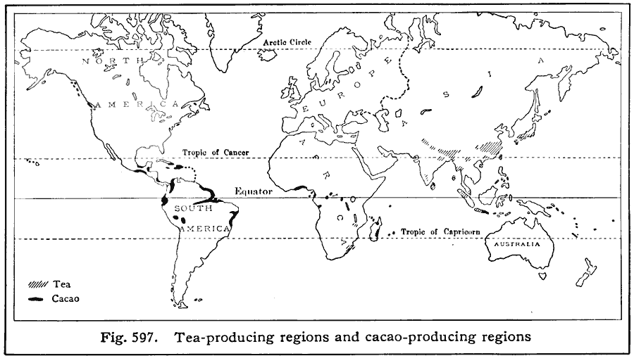
Description: A world map from 1916 showing the principal tea and cacao–producing regions of the world at the time. This map shows regions of tea with hatchures, and cacao in black. No figures for cacao–production are given in the text. Tea production is based on five–year averages; "The total production of tea in some countries is not reported. The worldŐs annual exports of tea amount to 773,000,000 pounds. Leading tea–exporting countries, with percentages of the worldŐs exports of tea: India (35%), China (26%), Ceylon (25%), Japan, etc. (8%). Among the leading tea–consuming countries Australia uses each year about seven pounds per person, Great Britain six pounds, and Canada five pounds. The United States uses only a little more than one pound per inhabitant."
Place Names: A Complete Map of Globes and Multi-continent, Africa, �Antarctica, �Asia, �Europe, �Australia, �North America, �South Americ
ISO Topic Categories: farming,
oceans,
location
Keywords: Tea and Cacao Production, statistical, kAgriculture, agriculture, farming,
oceans,
location, Unknown, 1916
Source: Albert Perry Brigham & Charles T. McFarlane, Essentials of Geography (New York, NY: American Book Company, 1916) 405
Map Credit: Courtesy the private collection of Roy Winkelman |
|