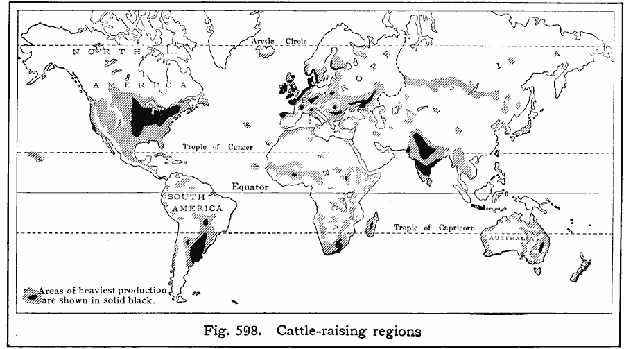
Description: A world map from 1916 showing the principal cattle–raising regions of the world at the time. The areas of heaviest production are shown in solid black. "WorldŐs total (excepting China), 500,000,000. The leading cattle–raising countries are: India (26%), United States (12%), Argentina (6%), Brazil (6%), European Russia (4%), Germany (4%), Russia in Asia (4%), France (3%), Australia (2%), Great Britain (2%). "
Place Names: A Complete Map of Globes and Multi-continent, Africa, �Antarctica, �Asia, �Australia, �Europe, �North America, �South Americ
ISO Topic Categories: farming,
location,
oceans
Keywords: Cattle-Raising Regions of the World, statistical, kAgriculture, agriculture, farming,
location,
oceans, Unknown, 1916
Source: Albert Perry Brigham & Charles T. McFarlane, Essentials of Geography (New York, NY: American Book Company, 1916) 405
Map Credit: Courtesy the private collection of Roy Winkelman |
|