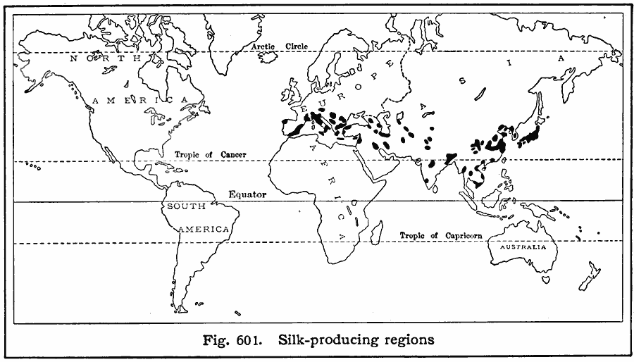
Description: A world map from 1916 showing the principal silk–producing regions of the world at the time. Based on five–year averages; "It is impossible to obtain accurate figures of the world production of raw silk, as the records of production in the Oriental countries are not complete. In the following table, therefore, the figures for Japan and China are for exports only. WorldŐs annual production, more than 55,000,000 pounds. Leading silk–producing countries, with percentages of the world average given above: Japan (50%), China (29%), Italy (14%). These three countries lead also in the exportation of raw silk to the United States. Leading countries exporting manufactured silk to the United States: France, Japan, Switzerland, Great Britain, Italy, and China."
Place Names: A Complete Map of Globes and Multi-continent, Africa, �Asia, �Antarctica, �Australia, �Europe, �North America, �South Americ
ISO Topic Categories: farming,
location,
oceans
Keywords: Silk Production, statistical, agriculture, farming,
location,
oceans, Unknown, 1916
Source: Albert Perry Brigham & Charles T. McFarlane, Essentials of Geography (New York, NY: American Book Company, 1916) 407
Map Credit: Courtesy the private collection of Roy Winkelman |
|