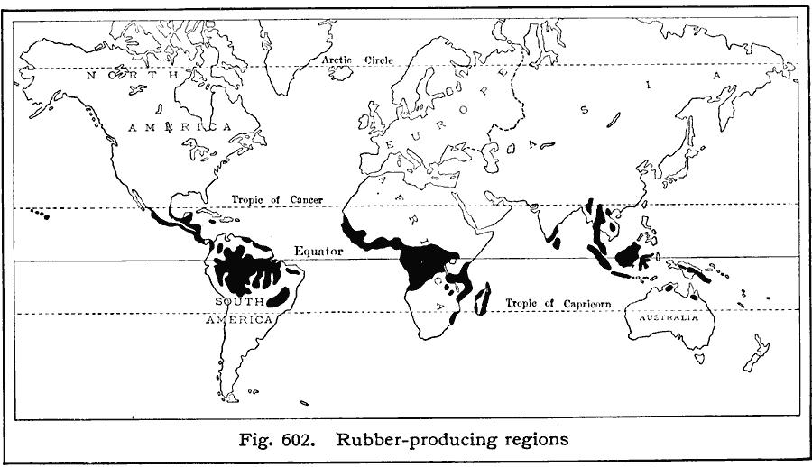
Description: A world map from 1916 showing the principal rubber–producing regions of the world at the time. Based on three–year averages; "WorldŐs annual production, 600,000,000 pounds. Leading sources of rubber, with percentages of world production: Plantation (84%), Brazil (12 ½%), Other sources (3 ½%). Most of the worldŐs rubber is now grown on plantations in the far East. Plantations have been developed in the Federal Malay States, Straits Settlements, Java, Sumatra, Ceylon, southern India, Borneo, and Dutch and British Guiana. Some rubber is also produced in the various colonies of west and central Africa, Philippine Islands, and Trinidad. Leading rubber–importing countries (chiefly for home consumption): United States (400,000,000 pounds), Great Britain (75,000,000 pounds), France (45,000,000 pounds), Canada (15,000,000 pounds), Italy (15,000,000 pounds)."
Place Names: A Complete Map of Globes and Multi-continent, Africa, �Antarctica, �Asia, �Australia, �Europe, �North America, �South Americ
ISO Topic Categories: farming,
location,
oceans
Keywords: Rubber Production, statistical, kAgriculture, agriculture, farming,
location,
oceans, Unknown, 1916
Source: Albert Perry Brigham & Charles T. McFarlane, Essentials of Geography (New York, NY: American Book Company, 1916) 407
Map Credit: Courtesy the private collection of Roy Winkelman |
|