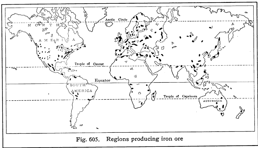
Description: A world map from 1916 showing the principal iron ore producing regions of the world at the time. "WorldŐs annual production of pig iron, 70,000,000 long tons. Countries leading in the production of pig iron, with percentages of world production: United States (57%), Great Britain (20%), Germany (about 12%), France (7%), Russia (6%), Czechoslovakia (3%), Belgium (2%). Annual production of pig iron in the United States, 40,000,000 tons. States leading in the production of pig iron, with percentages of United States production: Pennsylvania (41%), Ohio (22%), Illinois (10%), Alabama (7%), New York (6%). Annual production of iron ore in the United States, about 75,000,000 long tons. States leading in the mining of iron ore: Minnesota (60%), Michigan (24%), Alabama (9%).
Place Names: A Complete Map of Globes and Multi-continent, Africa, �Antarctica, �Asia, �Australia, �Europe, �North America, �South Americ
ISO Topic Categories: oceans,
location,
geoscientificInformation
Keywords: Iron Production, statistical, industry, oceans,
location,
geoscientificInformation, Unknown, 1916
Source: Albert Perry Brigham & Charles T. McFarlane, Essentials of Geography (New York, NY: American Book Company, 1916) 409
Map Credit: Courtesy the private collection of Roy Winkelman |
|