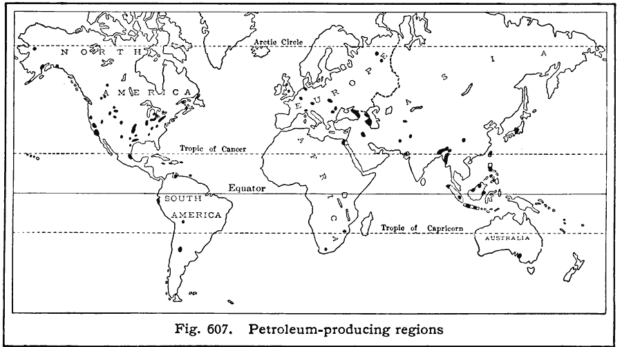
Description: A world map from 1916 showing the principal petroleum–producing regions of the world at the time. "WorldŐs annual production, 450,000,000 barrels of 42 gallons each. Leading petroleum–producing countries, with percentages of world production: United States (66%), Mexico (15%), Caucasus (13%), Roumania (3%), Dutch East Indies (3%), Poland (2%), India (2%). Petroleum production of the United States, 300,000,000 barrels a year. Leading petroleum–producing states, with percentages of United States production: Oklahoma (38%), California (33%), Texas (9%), Illinois (7%), Louisiana (6%)."
Place Names: A Complete Map of Globes and Multi-continent, Africa, �Antarctica, �Asia, �Australia, �Europe, �North America, �South Americ
ISO Topic Categories: geoscientificInformation,
location,
oceans
Keywords: Petroleum Production, statistical, kEconomic, industry, geoscientificInformation,
location,
oceans, Unknown, 1916
Source: Albert Perry Brigham & Charles T. McFarlane, Essentials of Geography (New York, NY: American Book Company, 1916) 410
Map Credit: Courtesy the private collection of Roy Winkelman |
|