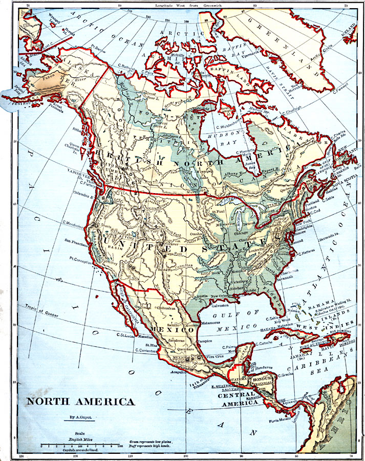
Description: A map from 1882 of North America, Central America, and the Caribbean, showing political boundaries at the time, major cities, mountain systems, lakes, rivers, and coastal features of the region. The map is color–coded to show general land elevations, with green representing lowland plains, and buff representing high lands. Capital cities are underlined, Canada is labled as British North America, and the island of San Salvador or Watling Island is shown as the landing site of Christopher Columbus.
Place Names: A Complete Map of North America, Canada, �United States, �Mexico, �Cuba, �Bahamas, �Guatemala, �Honduras, �Greenlan
ISO Topic Categories: boundaries,
inlandWaters,
oceans,
location
Keywords: North America, physical, �political, physical features, country borders, boundaries,
inlandWaters,
oceans,
location, Unknown, 1882
Source: , Guyot's New Intermediate Geography (New York, NY: Ivison, Blakeman & Company, 1882) 14
Map Credit: Courtesy the private collection of Roy Winkelman |
|