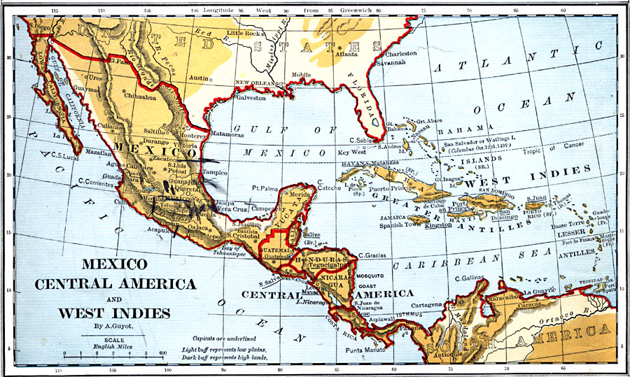
Description: A map from 1882 of Mexico, Central America, and the West Indies showing the political boundaries at the time, capitals and major cities, mountain systems, coastal features, and islands of the region. The map is color–coded to show the general land elevations, with light buff representing low plains and dark buff the high lands.
Place Names: A Regional Map of North America, Mexico, �Guatemala, �Honduras, �San Salvador, �Nicaragua, �Costa Rica, �Panam
ISO Topic Categories: boundaries,
inlandWaters,
location,
oceans
Keywords: Mexico, Central America, West Indies, physical, �political, kCaribbean, kCentralAmerica, physical features, country borders, boundaries,
inlandWaters,
location,
oceans, Unknown, 1882
Source: , Guyot's New Intermediate Geography (New York, NY: Ivison, Blakeman & Company, 1882) 56
Map Credit: Courtesy the private collection of Roy Winkelman |
|