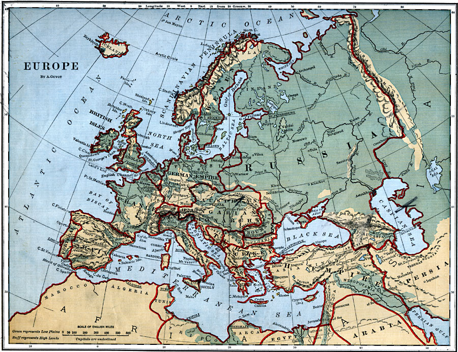
Description: A map of Europe in 1882 showing the German Empire, The Austrian–Hungarian Monarchy, and the Turkish Empire, including major cities, rivers, and other landforms.
Place Names: A Complete Map of Europe, Portugal, �Spain, �France, �England, �Scotland, �Ireland, �Iceland, �Switzerland, �Belgium, �Holland, �Denmark, �German Empire, �Italy, �Austrian-Hungarian Monarch, �Norway, �Sweden, �Turke
ISO Topic Categories: boundaries,
inlandWaters,
location,
oceans
Keywords: Europe, physical, �political, physical features, country borders, boundaries,
inlandWaters,
location,
oceans, Unknown, 1882
Source: , Guyot's New Intermediate Geography (New York, New York: Ivison, Blakeman & Company, 1882) 66
Map Credit: Courtesy the private collection of Roy Winkelman |
|