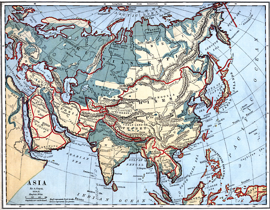
Description: A map from 1882 showing the physical features of Asia. This map is color-coded to show high lands in buff tints and low plains in green. Mountain systems, tablelands, and plains are shown, as well as major rivers, lakes, and coastal features. Political boundaries and capitals of the time are shown. The political divisions include the Russian Empire and Turkish Empire in Asia, the Chinese Empire, Jebel Shammar, El Hedjaz, Wahabee, Asir, Yemen, Hadramaut, and Oman in Arabia, Persia, Bokhara, Afghanistan, Beloochistan, Cashmere, India, Ceylon, Nepal, Bhotan, Burmah, Siam, Anam, Cambodia, Malay Peninsula, and Lower Cochin China.
Place Names: A Complete Map of Asia, Arabia, �Turkish Empire, �Persia, �Russian Empire, �Chinese Empire, �India, �Thibet, �Siberia, �China, �Indochina, �Philippine Islands, �Papau, �Japan Islands, �Egypt, �Afghanistan, �Beloochistan, �Bokhar
ISO Topic Categories: boundaries,
inlandWaters,
location,
oceans
Keywords: Physical Asia, physical, �political, physical features, country borders, boundaries,
inlandWaters,
location,
oceans, Unknown, 1882
Source: , Guyot's New Intermediate Geography (New York, NY: Ivison, Blakeman & Company, 1882) 78
Map Credit: Courtesy the private collection of Roy Winkelman |
|