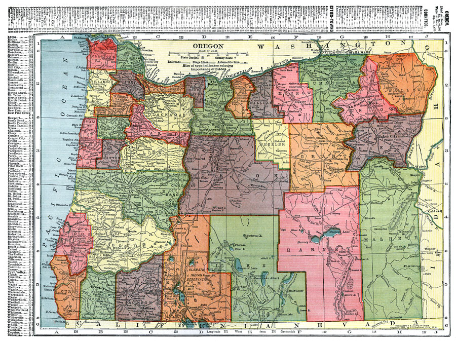
Description: A map from 1911 of Oregon showing the capital of Salem, counties and county seats, principal cities and towns, Indian reservations, railroads, stage lines, automobile lines, mountain systems, lakes, rivers, and coastal features. A grid reference in the margins of the map lists counties, principal cities, and towns of Oregon.
Place Names: Oregon, Oregon City, �Portland, �Salem, �Dalle
ISO Topic Categories: boundaries,
transportation,
location,
oceans,
inlandWaters
Keywords: Oregon, physical, �political, �transportation, kNativeAmerican, physical features, major political subdivisions,
county borders, railroads, boundaries,
transportation,
location,
oceans,
inlandWaters, Unknown, 1911
Source: C. S. Hammond, Hammond's Pictorial Atlas of the World (New York, NY: C. S. Hammond & Company, 1911) 128
Map Credit: Courtesy the private collection of Roy Winkelman |
|