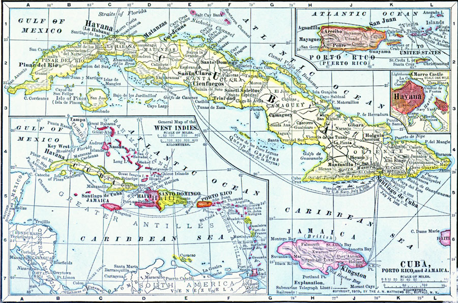
Description: Cuba, Puerto Rico, and Jamaica in 1919.
Place Names: A Regional Map of North America, Cuba, �Jamaica, �Puerto Rico, �West Indie
ISO Topic Categories: boundaries,
inlandWaters,
location,
oceans,
transportation
Keywords: Cuba, Porto Rico, and Jamaica, physical, �political, �borders, �boundaries, �historical, �World War I, �WWI, �transportation, �railroads, physical features, country borders, railroads, WWI, boundaries,
inlandWaters,
location,
oceans,
transportation, Unknown, 1914–1919
Source: Merton M. Wilner, A New Atlas of the New World Corrected According to the Peace Terms Together with a Graphic Story of the Great War 1914-1919 (New York, NY: The Christian Herald, 1919) 24
Map Credit: Courtesy the private collection of Roy Winkelman |
|