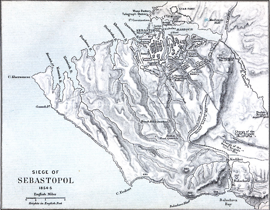
Description: A map showing Sebastopol, site of the Siege of Sebastopol which took place in 1854 to 1855.
Place Names: Ukraine, Sebastopol, �Sevastopol, �Mackenzie Hill, �Balachava Ba
ISO Topic Categories: location,
inlandWaters,
oceans
Keywords: Siege of Sebastopol, historical, �physical, �battle of sevastopol, black sea fleet, crimean war, siege of sebastopol, physical features,
topographical, other military,
historical event, location,
inlandWaters,
oceans, Unknown, 1854–1855
Source: Samuel Rawson Gardiner, D.C.L., LL.D., A School Atlas of English history (London, England: Logmans, Green, and Co., 1914) 88
Map Credit: Courtesy the private collection of Roy Winkelman |
|