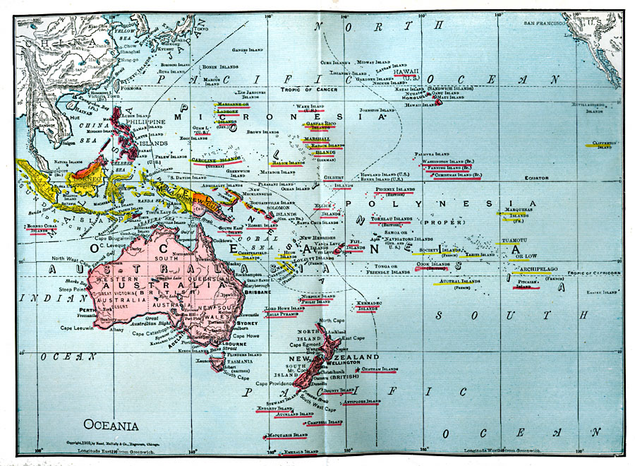
Description: A map from 1906 of Oceania and the Pacific between latitudes 30° N and 50° S, and longitudes 95° E and 110° W of Greenwich. This map shows cities and ports, rivers, lakes, terrain, coral reefs, and coastal features of the region. Oceania is subdivided to show the territorial island groups of Malaysia, Australasia, and Polynesia. This map is color–coded to show the foreign possessions of Britain, France, Germany, Netherlands, and the United States at the time.
Place Names: Regional Pacific Ocean, New Zealand, �Marshal Islands, �Solomon Islands, �Papua New Guinea, �Kiribati, �French Polynesia, �Federated States of Micronesia, �Australia, �Hawaiian Islands, �Indonesi
ISO Topic Categories: physical, �political, kWorldPacific
Keywords: Oceania, physical, �political, physical features, country borders,
major political subdivisions, physical, �political, kWorldPacific, Unknown, 1906
Source: L. Brent Vaughan, Hill's Practical Reference Library of General Knowledge (Chicago, IL: Dixon, Hanson, & Company, 1906) last tab
Map Credit: Courtesy the private collection of Roy Winkelman |
|