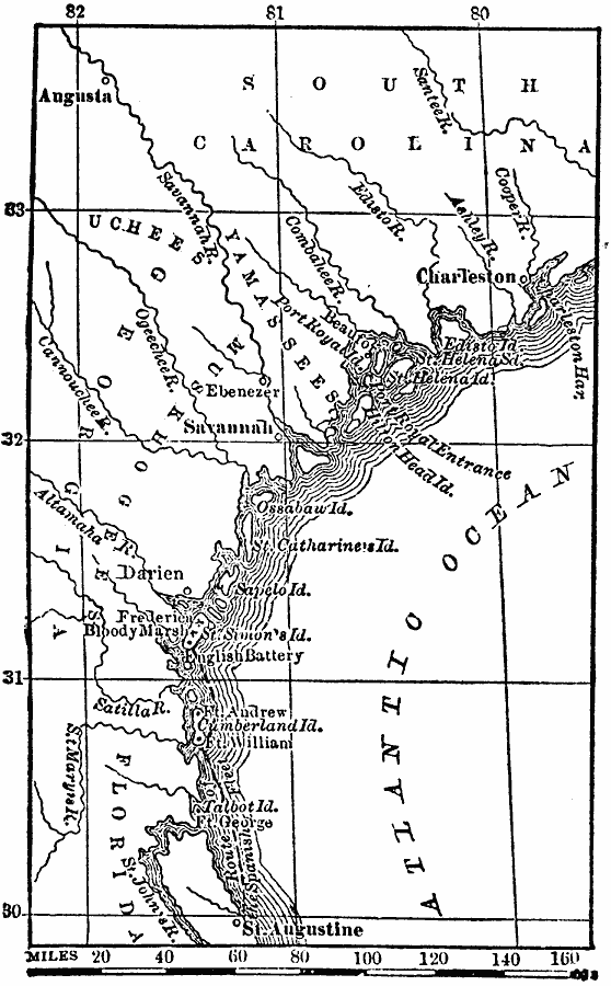
Description: A map of the Spanish route from St. Augustine near the British Fort Frederica in 1742 during the War of Jenkin's Ear. The map shows the battle site of Bloody Marsh on St. Simons Island, and the site of the English battery.
Place Names: Georgia, Savannah, �Charleston, �August
ISO Topic Categories: location,
oceans,
inlandWaters
Keywords: Vicinity of Fort Frederica, physical, physical features, location,
oceans,
inlandWaters, Unknown, 1742
Source: W. H. De Puy, People's Cyclopedia of Universal Knowledge Vol 1 (New York, NY: Phillips & Hunt, 1881) 793
Map Credit: Courtesy the private collection of Roy Winkelman |
|