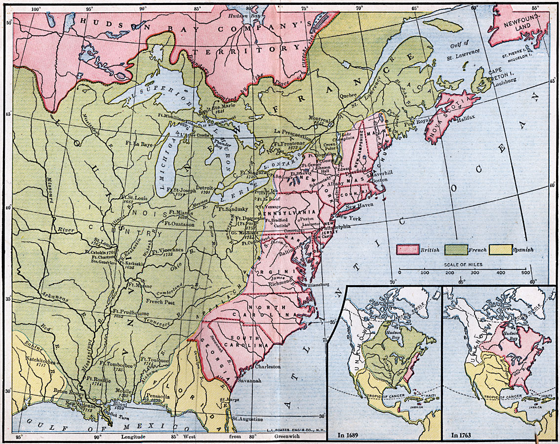
Description: A map of North America showing the French posts and forts at the beginning of the French and Indian War (1754) between the French and the British. The map is color–coded to show the territorial claims of the British, French, and Spanish at the time. The map coverage includes the southern portion of the Hudson Bay Company territory (British), New France, Nova Scotia, the Thirteen British Colonies, Louisiana, and Spanish Florida at the time. Inset maps show the entire North America, Central America, and Caribbean region, with the same color–coding to indicate territorial possessions in 1689 and in 1763 at the end of the French and Indian War. These maps also show the unexplored territories of the northwestern portion of North America.
Place Names: A Regional Map of North America, United States, �Canad
ISO Topic Categories: boundaries,
location,
oceans,
inlandWaters
Keywords: French Posts and Forts in Louisiana and New France, physical, �political, physical features, major political subdivisions, boundaries,
location,
oceans,
inlandWaters, Unknown, 1754
Source: Robert Hall, Harriet Smither, and Clarence Ousley, A History of the United States (Dallas, TX: The Southern Publishing Company, 1920) 115-114
Map Credit: Courtesy the private collection of Roy Winkelman |
|