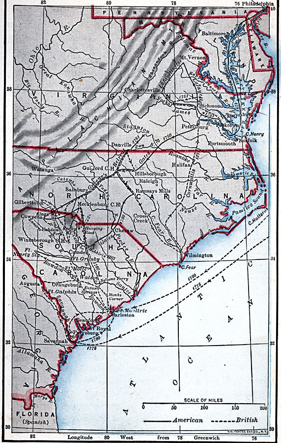
Description: A map of the southern colonies during the Revolutionary War in the south, showing the colony boundaries at the time, major cities and ports, terrain and coastal features, and rivers. This map shows the routes of campaigns with dates, American campaigns given by a solid line, and British campaigns a dashed line. Forts and battle sites in the region are indicated.
Place Names: South Atlantic States, North Carolina, �South Carolina, �Georgia, �Maryland, �Delawar
ISO Topic Categories: transportation,
location,
intelligenceMilitary,
inlandWaters,
oceans,
boundaries
Keywords: Southern Campaigns of the Revolutionary War, physical, �political, �transportation, physical features, country borders, water routes, transportation,
location,
intelligenceMilitary,
inlandWaters,
oceans,
boundaries, Unknown, 1778–1783
Source: Robert Hall, Harriet Smither, and Clarence Ousley, A History of the United States (Dallas, TX: The Southern Publishing Company, 1920) 169
Map Credit: Courtesy the private collection of Roy Winkelman |
|