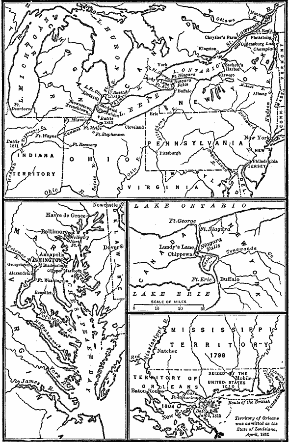
Description: A series of maps showing the principal campaigns, forts, and battle sites of the War of 1812, including: a map of the northern seat of war in the Great Lakes region of Canada, New York, Pennsylvania, Ohio, and the Michigan Territory; a map of the Chesapeake Bay area, a detail of the Niagara River area, and a map of the southern seat of war.
Place Names: Growth of Nation, Pennsylvania, �Indiana Territory, �Virginia, �Ohio, �Maryland, �Canada, �Dover, �Chesapeake Bay, �Mississippi Territory, �War of 181
ISO Topic Categories: boundaries,
location,
oceans,
inlandWaters,
intelligenceMilitary
Keywords: War of 1812, historical, �physical, �political, physical features, major political subdivisions, American Revolution, boundaries,
location,
oceans,
inlandWaters,
intelligenceMilitary, Unknown, 1812
Source: Robert Hall, Harriet Smither, and Clarence Ousley, A History of the United States (Dallas, TX: The Southern Publishing Company, 1920) 232
Map Credit: Courtesy the private collection of Roy Winkelman |
|