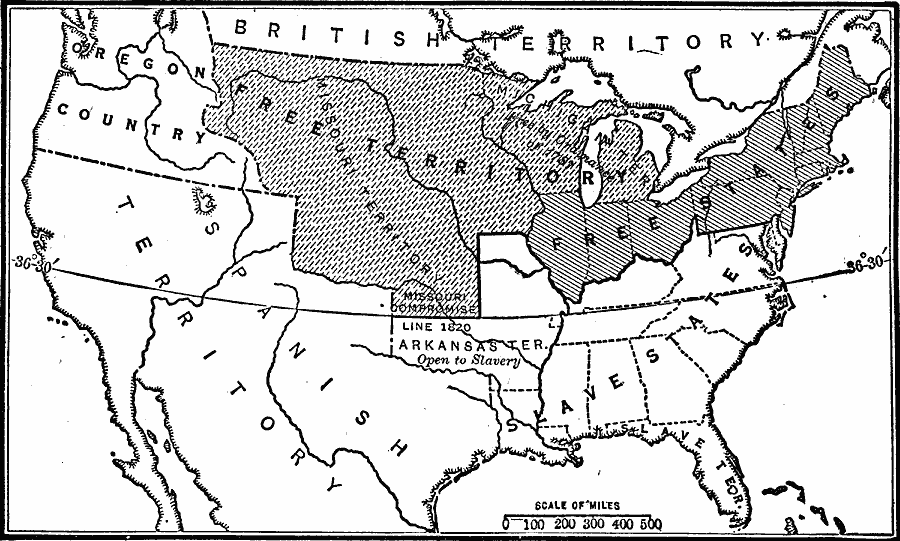
Description: A map of the United States at the time of the Missouri Compromise of 1820. The map is keyed to show the free states, free territory, slave holding states, and shows the Missouri Compromise Line at latitude 30°30’ N.
Place Names: Growth of Nation, Free Territory, �Free States, �Slave States, �Spanish Territory, �Oregon County, �Arkansas Territory, �Oregon Country, �British Territory, �Missour
ISO Topic Categories: oceans,
location,
inlandWaters,
boundaries
Keywords: The Missouri Compromise, physical, �political, �historical, �Missouri Compromise, physical features, country borders,
major political subdivisions, oceans,
location,
inlandWaters,
boundaries, Unknown, 1820
Source: Robert Hall, Harriet Smither, and Clarence Ousley, A History of the United States (Dallas, TX: The Southern Publishing Company, 1920) 247
Map Credit: Courtesy the private collection of Roy Winkelman |
|