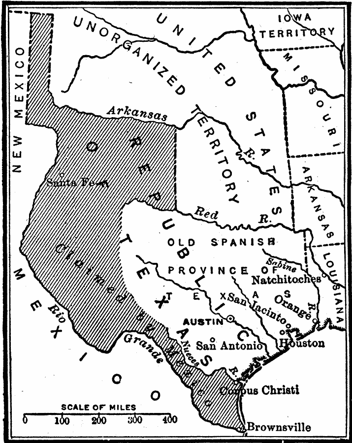
Description: A map showing the disputed territory in 1846 between the Nueces River, claimed to be the territory boundary by Mexico, and the Rio Grande River, claimed to be the boundary by the Republic of Texas. The map also shows the old Spanish province of Texas extending to the Red River and Sabine River as established by the Louisiana Purchase of 1803.
Place Names: Growth of Nation, Texas, �Iowa Territory, �Arkansas, �Louisiana, �Missouri, �San Antonio, �Austin, �Houston, �Corpus Christi, �Mexican American Wa
ISO Topic Categories: boundaries,
location,
inlandWaters,
oceans
Keywords: Dispute Between United States and Mexico, physical, �political, physical features, major political subdivisions,
country borders, boundaries,
location,
inlandWaters,
oceans, Unknown, 1846
Source: Robert Hall, Harriet Smither, and Clarence Ousley, A History of the United States (Dallas, TX: The Southern Publishing Company, 1920) 296
Map Credit: Courtesy the private collection of Roy Winkelman |
|