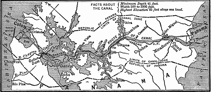
Description: A map from 1903 of the Panama Canal Zone showing the Canal Zone boundaries, the channel route from Colon to the city of Panama, railroad route, lakes, reservoirs, locks, and towns along the canal. Map notes indicate the minimum depth of the canal to be 41 feet, width 500 to 1000 feet, and the highest surface elevation 85 feet above sea level.
Place Names: Panama Canal Zone, Panama, �Gatun, �Colon, �Culebr
ISO Topic Categories: boundaries,
transportation,
inlandWaters,
location,
oceans
Keywords: Panama Canal Zone, physical, �transportation, �political, physical features, local jurisdictions, water routes,
railroads, boundaries,
transportation,
inlandWaters,
location,
oceans, Unknown, 1903
Source: Robert Hall, Harriet Smither, and Clarence Ousley, A History of the United States (Dallas, TX: The Southern Publishing Company, 1920) 445
Map Credit: Courtesy the private collection of Roy Winkelman |
|
