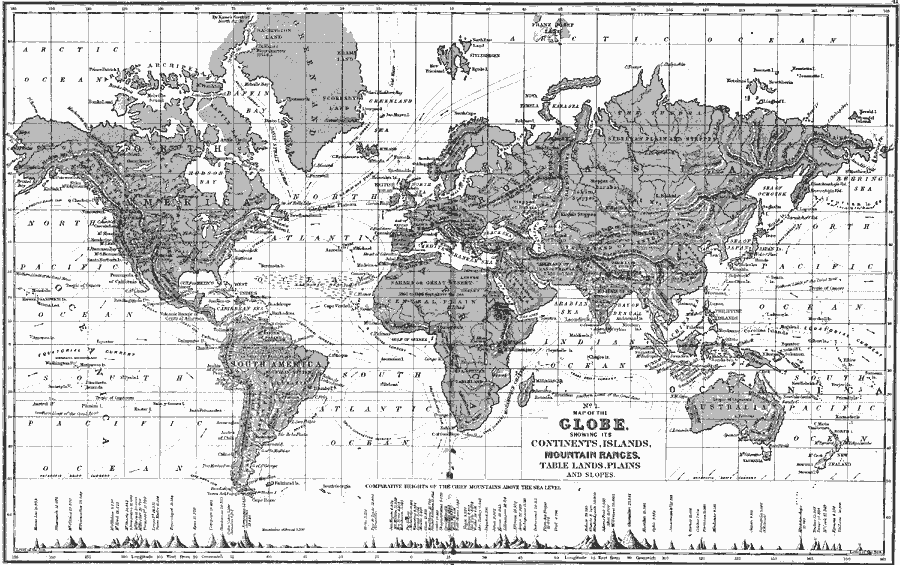
Description: A map of the world from 1890 showing its continents, islands, mountain ranges, table lands, plains and slopes, rivers, forests, and deserts. This map shows ocean currents with direction of flow, the northern and southern limits of the coral zone, and the Sargasso Sea. Several predominant mountain peaks (including oceanic islands) are pictorially shown at the bottom of the map for comparative heights in feet above sea level.
Place Names: A Complete Map of Globes and Multi-continent, Africa, �Asia, �Australia, �Europe, �North America, �South Americ
ISO Topic Categories: inlandWaters,
location,
oceans,
elevation
Keywords: Map of the Globe, physical, �historical, physical features,
topographical, inlandWaters,
location,
oceans,
elevation, Unknown, 1890
Source: John Brocklesby, Elements of Physical Geography (Philadelphia, Pennsylvania: E. H. Butler and Co., 1890) 40-41
Map Credit: Courtesy the private collection of Roy Winkelman |
|