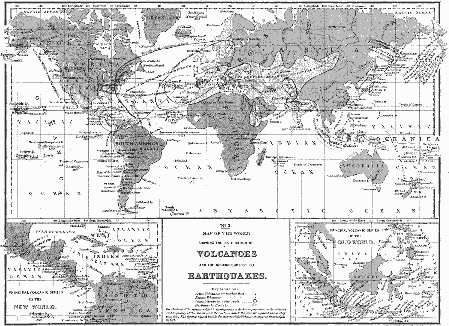
Description: A map of the world from 1890 showing the distribution of volcanoes and the regions subject to earthquakes. This map shows the locations of active volcanoes, extinct volcanoes, central groups of volcanoes (volcanic series of North America, Mexico, Peru and Bolivia, Chile, Australia, and the Sunda Islands), and earthquake districts. The eruption of Nicaragua's Cosiguina Volcano (20 January, 1835) is noted, as well as the appearances of submarine eruptions in the Atlantic between Africa and South America. Several earthquake events, including dates, are shown, specifically the Great Earthquake of Lisbon (1 November, 1755), showing the extent of the quake's limit of concussion and the probable limit of agitations of waves along the East Coast of the Unites States. Inset maps detail the principal volcanic series of the New World and Old World. "The shading of the regions subject to Earthquakes is darker in proportion to the violence and frequency of the shocks, and the red lines denote the area throughout which they were felt. The figures placed beside the names of the Volcanoes express their height in feet."
Place Names: A Complete Map of Globes and Multi-continent, North America, �South America, �Africa, �Europe, �Greenland, �Asia, �Australi
ISO Topic Categories: inlandWaters,
location,
oceans
Keywords: Distribution of Volcanoes and the Regions subject to Earthquakes, physical, kGeology, physical features,
geological, inlandWaters,
location,
oceans, Unknown, 1890
Source: John Brocklesby, Elements of Physical Geography (Philadelphia, Pennsylvania: E. H. Butler and Co., 1890) 50
Map Credit: Courtesy the private collection of Roy Winkelman |
|