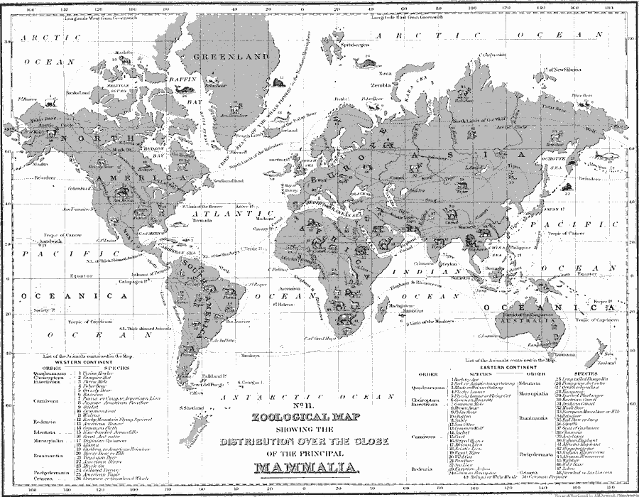
Description: A world map from 1890 showing the distribution of principal or representative species of mammalia across the globe. The map divides the world into the Western Continent (North and South America) and the Eastern Continent (Europe, Asia, Africa, and Australia). Orders of mammals of the Western Continent as described in the text include apes and monkeys (Quarumana), bats (Cheiroptera), insect–eating animals (Insectivora), carnivores (Carnivora), rodents (Rodentia), ant–eaters, sloths, and armadillos (Edentata), marsupials (Marsupialia), ruminators (Ruminantia), elephants and rhinoceros (Pachydermata), and whales and porpoise (Cetacea), with representative species shown by number. The species are also shown pictorially on the map, and dashed lines show the districts or limits of the species range.
Place Names: A Complete Map of Globes and Multi-continent, Africa, �Antarctica, �Asia, �Australia, �Europe, �North America, �South Americ
ISO Topic Categories: inlandWaters,
location,
oceans,
biota
Keywords: Zoological Map of Mammalia, physical, �statistical, �animals, �mammalia, kBiodiversity, physical features, inlandWaters,
location,
oceans,
biota, Unknown, 1890
Source: John Brocklesby, Elements of Physical Geography (Philadelphia, Pennsylvania: E. H. Butler and Co., 1890) 138
Map Credit: Courtesy the private collection of Roy Winkelman |
|