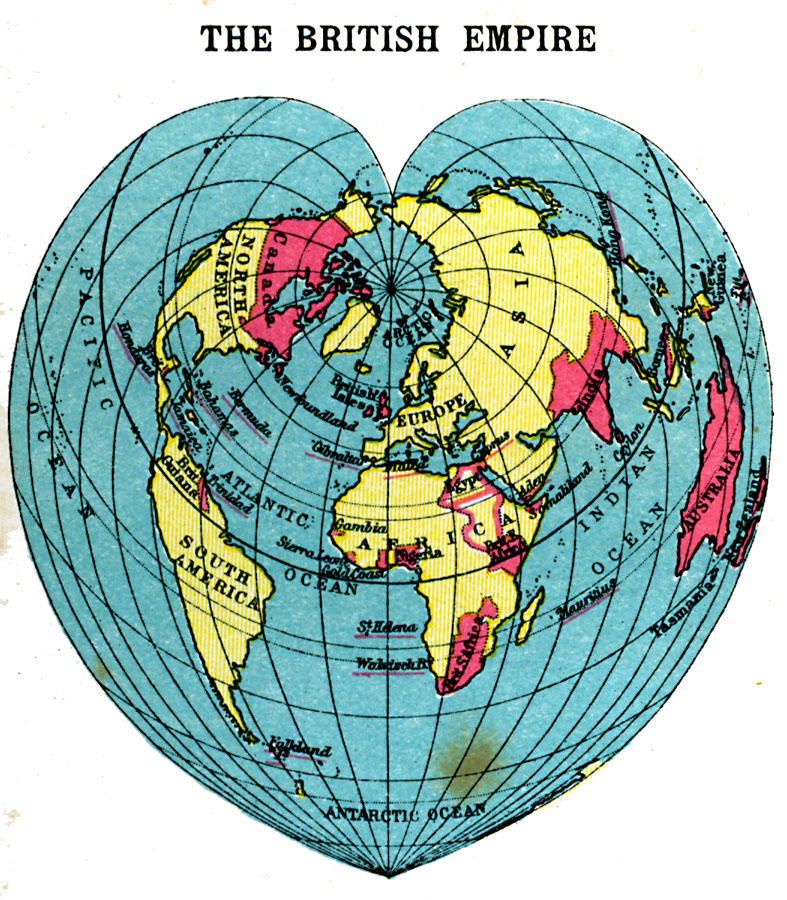
Description: A cordiform (heart–shaped) map of the world from 1920, showing the extent of the British Empire at the time. British possessions are shown in red, with the names of smaller possessions (British Honduras, Bermuda, Bahamas, Jamaica, Trinidad, Falkland Islands, Walvisch Bay, St. Helena, Gibraltar, Malta, Cyprus, Aden, Mauritius, Hong Kong, and Fuji Islands) underlined in red.
Place Names: A Complete Map of Globes and Multi-continent, Africa, �Antarctica, �Asia, �Australia, �Europe, �North America, �South Americ
ISO Topic Categories: boundaries,
location,
oceans
Keywords: British Empire, physical, �political, kMapProjection, physical features, country borders,
major political subdivisions, boundaries,
location,
oceans, Unknown, 1920
Source: , Asprey's Atlas of the World (London, England: Asprey and Co., Ltd., 1920) 1
Map Credit: Courtesy the private collection of Roy Winkelman |
|