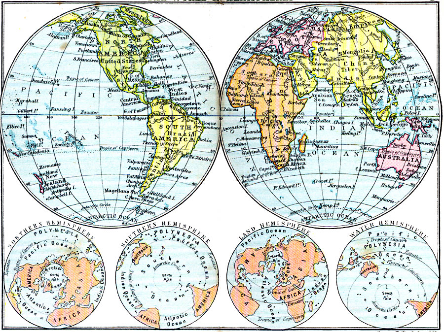
Description: A map from 1920 showing the world in hemispheric perspectives, including the Western and Eastern hemispheres, Southern and Northern polar hemispheres, and the ‘Land’ and ‘Water’ hemispheres. The Southern Hemisphere shown on this map is interesting in that the Antarctic continent is not shown (unexplored at the time).
Place Names: A Complete Map of Globes and Multi-continent, Africa, �Asia, �Australia, �Europe, �North America, �South America, �Antarctic
ISO Topic Categories: inlandWaters,
location,
oceans
Keywords: The World in Hemispheres, physical, physical features, inlandWaters,
location,
oceans, Unknown, 1920
Source: , Asprey's Atlas of the World (London, England: Asprey and Co., Ltd., 1920) 2
Map Credit: Courtesy the private collection of Roy Winkelman |
|