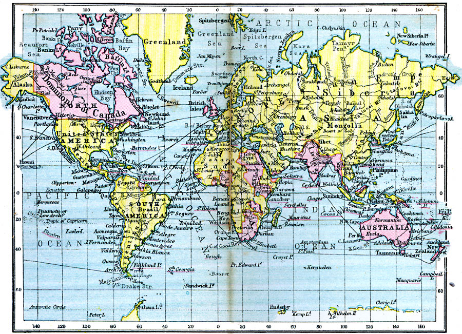
Description: A map of the world from 1920 showing the British Empire and commercial highways. This map uses the Mercator projection to show the extent of the British Empire (in pink, with the names of smaller possessions underlined in red), major railways, and steamship routes at the time.
Place Names: A Complete Map of Globes and Multi-continent, Africa, �Antarctica, �Asia, �Australia, �Europe, �North America, �South Americ
ISO Topic Categories: boundaries,
inlandWaters,
location,
oceans,
transportation
Keywords: British Empire and Commercial Highways, physical, �political, �transportation, physical features, country borders,
major political subdivisions, water routes,
railroads, boundaries,
inlandWaters,
location,
oceans,
transportation, Unknown, 1920
Source: , Asprey's Atlas of the World (London, England: Asprey and Co., Ltd., 1920) 4
Map Credit: Courtesy the private collection of Roy Winkelman |
|