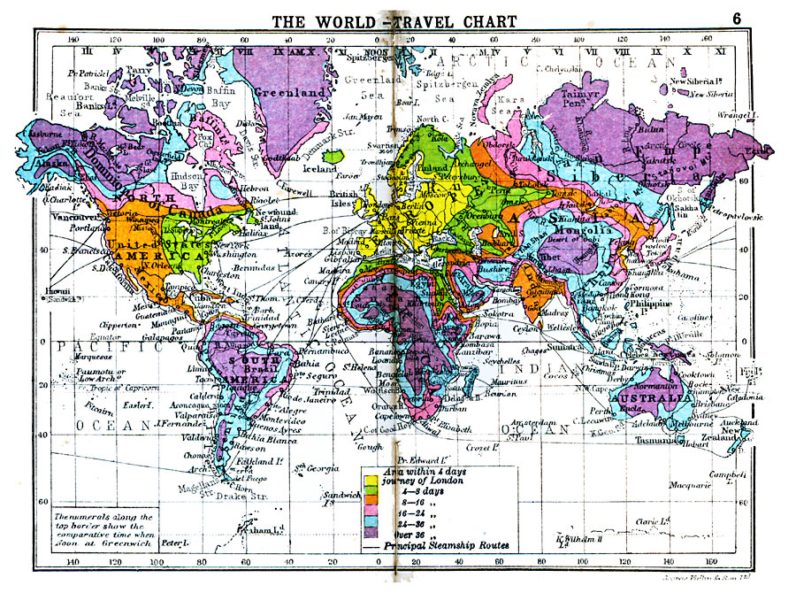
Description: A world travel chart from 1920, showing the amount of time needed to travel to the various localities of the world starting in London. The map is color–coded to show the travel time required to travel from London within four days (yellow), 4 – 8 days (green), 8 – 16 days (orange), 16 – 24 days (pink), 24 – 36 days (light blue), and over 36 days (purple). Principal trans–ocean steamship routes are shown, and the numerals along the top border show the comparative time when it is Noon at Greenwich.
Place Names: A Complete Map of Globes and Multi-continent, Africa, �Antarctica, �Asia, �Europe, �Australia, �North America, �South Americ
ISO Topic Categories: boundaries,
transportation,
inlandWaters,
location,
oceans
Keywords: World Travel Chart, physical, �political, �transportation, physical features, country borders, water routes,
railroads, boundaries,
transportation,
inlandWaters,
location,
oceans, Unknown, 1920
Source: , Asprey's Atlas of the World (London, England: Asprey and Co., Ltd., 1920) 6
Map Credit: Courtesy the private collection of Roy Winkelman |
|