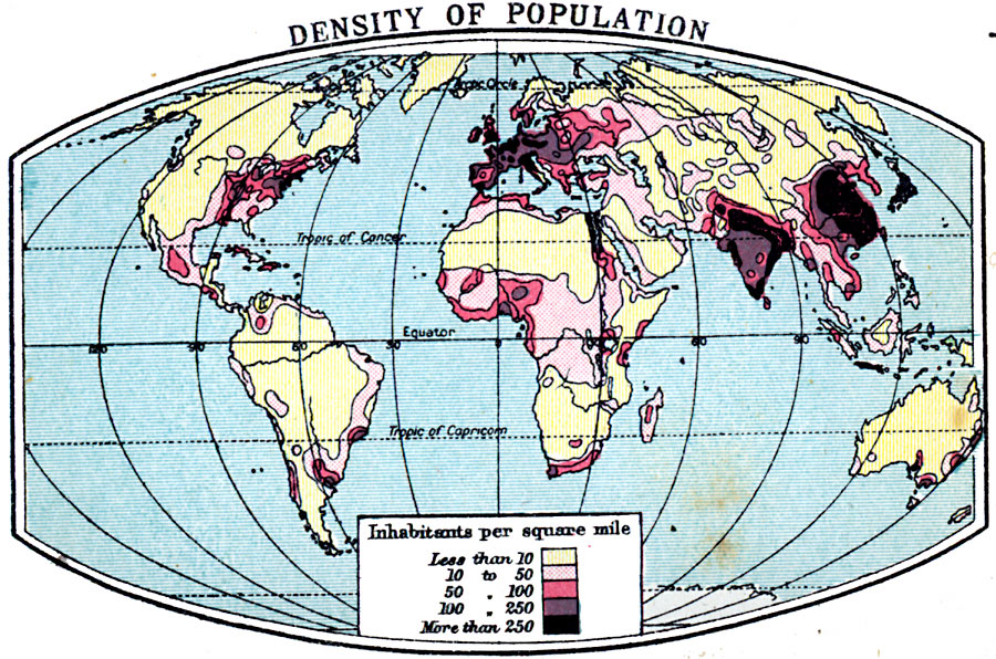
Description: A world map from 1920 showing density of population throughout the world. This map is color–coded to show regions of population with density under 10 persons per square mile, to regions of population density of over 250 persons per square mile.
Place Names: A Complete Map of Globes and Multi-continent, Africa, �Antarctica, �Asia, �Australia, �Europe, �North America, �South Americ
ISO Topic Categories: inlandWaters
Keywords: Density of Population, physical, �statistical, kPopulation, physical features, population, inlandWaters, Unknown, 1920
Source: , Asprey's Atlas of the World (London, England: Asprey and Co., Ltd., 1920) 7
Map Credit: Courtesy the private collection of Roy Winkelman |
|