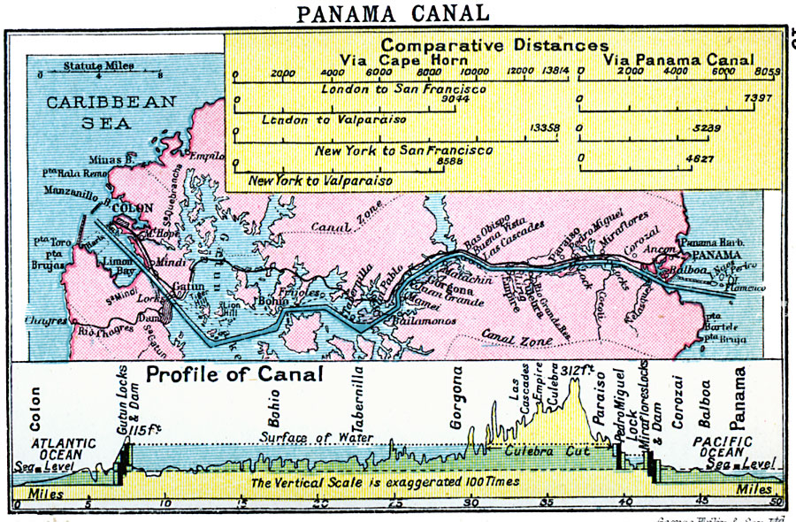
Description: A map from 1920 of the Panama Canal showing the Canal Zone boundaries, the channel route from Colon to the city of Panama, railroad route, lakes, reservoirs, locks, and towns along the canal. A chart at the top of the map shows the comparative port to port distances via the canal and via the Cape Horn routes for London and New York to San Francisco, and London and New York to Valparaiso, Chile. The chart at the bottom of the map is a profile of the isthmus and canal with a vertical exaggeration 100 times actual.
Place Names: Panama Canal Zone, Colon, �Panam
ISO Topic Categories: inlandWaters,
location,
oceans,
transportation
Keywords: Panama Canal, physical, �transportation, physical features, water routes, inlandWaters,
location,
oceans,
transportation, Unknown, 1920
Source: , Asprey's Atlas of the World (London, England: Asprey and Co., Ltd., 1920) 13
Map Credit: Courtesy the private collection of Roy Winkelman |
|