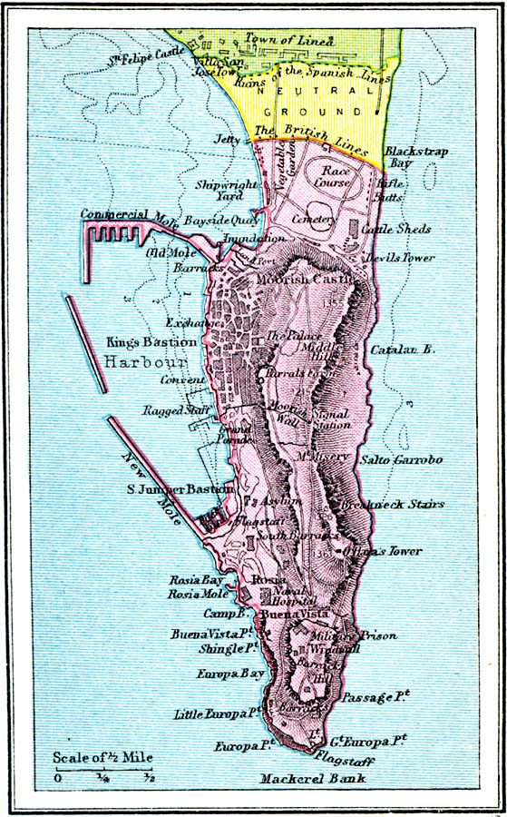
Description: A detail map of the Rock of Gibraltar in 1920, showing the area under British control, the neutral zone with Spain, and the town of Linea (La Linea de la Concepción). This map includes O'Hara's Tower, the Moorish Castle, Breakneck Stairs, King's Bastion, Europa Point, the Moorish Wall, the Military Prison, and the Governor's Grounds near the neutral zone with its race track, cattle sheds, vegetable gardens, and cemetery.
Place Names: Spain, United Kingdom, �Spai
ISO Topic Categories: boundaries,
location,
oceans
Keywords: Gibraltar, physical, �political, physical features, country borders, boundaries,
location,
oceans, Unknown, 1920
Source: , Asprey's Atlas of the World (London, England: Asprey and Co., Ltd., 1920) 15
Map Credit: Courtesy the private collection of Roy Winkelman |
|