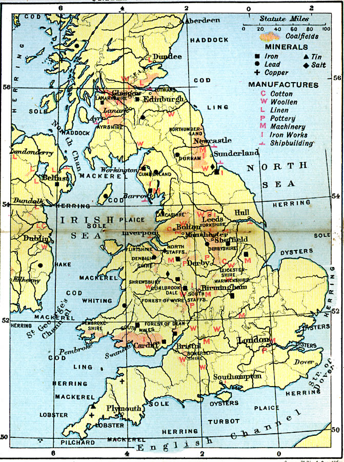
Description: A map of the United Kingdom from 1920, showing the coalfield districts, areas of iron, lead, copper, tin and salt mining, fisheries, and cotton, woolen, linen, pottery, machinery, iron, and shipbuilding manufactory.
Place Names: United Kingdom, Dundee, �Edinburgh, �Sunderland, �Hull, �Derby, �Birmingham, �Bristol, �Plymouth, �Southampton, �London, �Dublin, �Belfast, �Newcastle, �Glasgo
ISO Topic Categories: inlandWaters,
location,
oceans,
economy
Keywords: United Kingdom Industries, physical, �political, �statistical, �Iron, �Tin, �Lead, �Salt, �Copper, �Cotton, �Woollen, �Linen, �Pottery, �Machinery, �Iron Works, �Shipbuilding, kIndustry, physical features, major political subdivisions, industry,
economic, inlandWaters,
location,
oceans,
economy, Unknown, 1920
Source: , Asprey's Atlas of the World (London, England: Asprey and Co., Ltd., 1920) 20
Map Credit: Courtesy the private collection of Roy Winkelman |
|