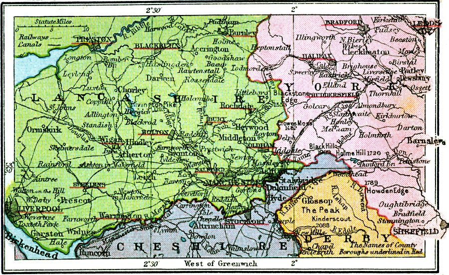
Description: A map of the Lancashire and York manufacturing district of England in 1920, showing the major cities and ports of Liverpool, Preston, Manchester, Stockport, Bolton, Oldham, Sheffield, Halifax, Bradford, and Leeds. The map shows railroads, canals, rivers, cities and towns, and the County Boroughs underlined in red.
Place Names: United Kingdom, Lancashire, �York, �Cheshire, �Derb
ISO Topic Categories: boundaries,
inlandWaters,
location,
transportation
Keywords: Lancashire and Yorkshire Manufacturing District, physical, �political, �transportation, kEconomic, physical features, major political subdivisions, roads,
railroads, boundaries,
inlandWaters,
location,
transportation, Unknown, 1920
Source: , Asprey's Atlas of the World (London, England: Asprey and Co., Ltd., 1920) 21
Map Credit: Courtesy the private collection of Roy Winkelman |
|