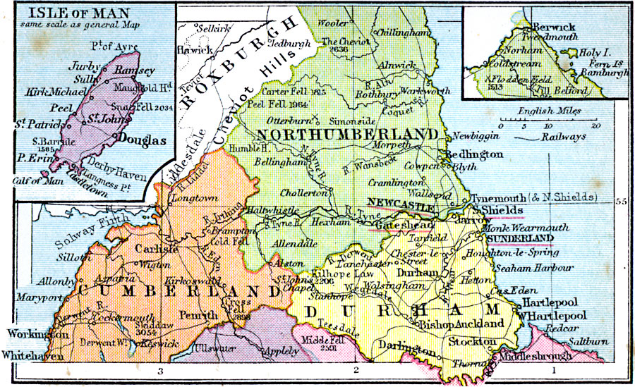
Description: A regional map of northern England from 1920, showing major cities, towns, and ports, railways and canals, and counties with the county boroughs underlined in red. The map shows major rivers and prominent peaks with elevations in feet. This map shows the counties of Northumberland, Cumberland, and Durham, with inset maps of the Isle of Man, and the northern portion of Northumberland. The battle sites of Flodden Field and Otterburn are shown.
Place Names: United Kingdom, Northumberland, �Cumberland, �Durham, �Roxburgh, �Isle of Ma
ISO Topic Categories: boundaries,
inlandWaters,
location,
oceans,
transportation
Keywords: England Plate II, physical, �political, �transportation, physical features, major political subdivisions,
country borders, railroads, boundaries,
inlandWaters,
location,
oceans,
transportation, Unknown, 1920
Source: , Asprey's Atlas of the World (London, England: Asprey and Co., Ltd., 1920) 25
Map Credit: Courtesy the private collection of Roy Winkelman |
|