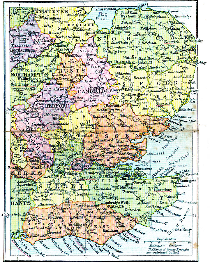
Description: A regional map of southeastern England from 1920, showing major cities, towns, and ports, railways and canals, and counties with the county boroughs underlined in red. The map shows major rivers and coastal features. This map shows the counties of Rutland, Hunts, Isle of Ely, Norfolk, Bedford, Cambridge, Suffolk, Buckingham, Hertford, Middlesex, Essex, London, Surry, Kent, and Sussex, with portions of Leicester, Stafford, Northampton, Oxford, Berks, and Hants.
Place Names: United Kingdom, Norfolk, �Leicester, �Rutland, �Northampton, �Hunts, �Cambridge, �Bedford, �Buckingham, �Oxford, �Berks, �Essex, �Hertford, �Middlesex, �London, �Surrey, �Hants, �Sussex, �Ken
ISO Topic Categories: boundaries,
inlandWaters,
location,
oceans,
transportation
Keywords: England Plate III, physical, �political, �transportation, physical features, major political subdivisions, railroads,
water routes, boundaries,
inlandWaters,
location,
oceans,
transportation, Unknown, 1920
Source: , Asprey's Atlas of the World (London, England: Asprey and Co., Ltd., 1920) 26
Map Credit: Courtesy the private collection of Roy Winkelman |
|