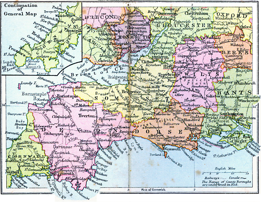
Description: A regional map of southwestern England from 1920, showing major cities, towns, and ports, railways and canals, and counties with the county boroughs underlined in red. The map shows important battle sites, major rivers, prominent mountains and hills with elevations, and coastal features. This map shows the counties of Gloucester, Wilts, Somerset, Dorset, Devon, and Cornwall, with portions of Oxford, Berks, and Hants and Isle of Wight, and an inset map of the western portion of Cornwall.
Place Names: United Kingdom, Brecon, �Glamorgan, �Monmouth, �Gloucester, �Berks, �Wilts, �Somerset, �Devon, �Cornwall, �Dorset, �Hants, �Oxfor
ISO Topic Categories: boundaries,
inlandWaters,
location,
oceans,
transportation
Keywords: England Plate IV, physical, �political, �transportation, physical features, major political subdivisions, railroads,
water routes, boundaries,
inlandWaters,
location,
oceans,
transportation, Unknown, 1920
Source: , Asprey's Atlas of the World (London, England: Asprey and Co., Ltd., 1920) 28
Map Credit: Courtesy the private collection of Roy Winkelman |
|