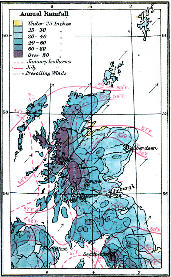
Description: A climate map of Scotland from 1920, color–coded to show averaged annual rainfall ranging from under 25 to over 80 inches, isotherms of mean January and July temperatures in degrees Fahrenheit, and the direction of prevailing winds.
Place Names: United Kingdom, Aberdeen, �William, �Glasgow, �Edinburgh, �Glengyl
ISO Topic Categories: inlandWaters,
location,
oceans,
climatologyMeteorologyAtmosphere
Keywords: Climate Map of Scotland: Mean Annual Rainfall and January/July Temperature Averages, physical, �meteorological, kClimate, physical features, climate,
winds,
rainfall,
temperature, inlandWaters,
location,
oceans,
climatologyMeteorologyAtmosphere, Unknown, 1920
Source: , Asprey's Atlas of the World (London, England: Asprey and Co., Ltd., 1920) 31
Map Credit: Courtesy the private collection of Roy Winkelman |
|