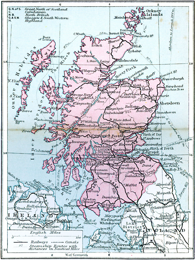
Description: A map of Scotland from 1920, showing the railway network of the Great North of Scotland, Caledonian, North British, Glasgow and South Western, and Highland lines. This map also shows primary steamship routes with distances in nautical miles, canals, rivers, majors cities, towns, and ports.
Place Names: United Kingdom, Edinburgh, �Dundee, �Dumfries, �Orkney Islands, �Inverness, �Aberdeen, �Glasgo
ISO Topic Categories: boundaries,
inlandWaters,
location,
oceans,
transportation
Keywords: Scotland Transportation System, physical, �political, �transportation, kTransportation, physical features, country borders, railroads,
water routes, boundaries,
inlandWaters,
location,
oceans,
transportation, Unknown, 1920
Source: , Asprey's Atlas of the World (London, England: Asprey and Co., Ltd., 1920) 32
Map Credit: Courtesy the private collection of Roy Winkelman |
|