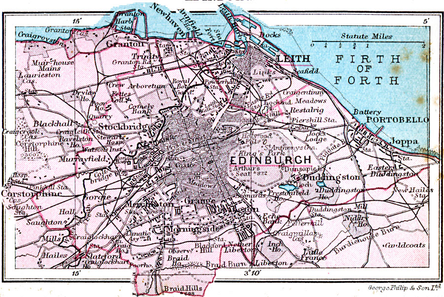
Description: A map of Edinburgh, Scotland in 1920, showing landmarks of the city, parks, railways and stations, port facilities on the Firth of Forth, and neighboring cities and towns.
Place Names: United Kingdom, Edinboroug
ISO Topic Categories: inlandWaters,
location,
transportation
Keywords: Edinburgh, physical, �transportation, physical features, roads, inlandWaters,
location,
transportation, Unknown, 1920
Source: , Asprey's Atlas of the World (London, England: Asprey and Co., Ltd., 1920) 33
Map Credit: Courtesy the private collection of Roy Winkelman |
|