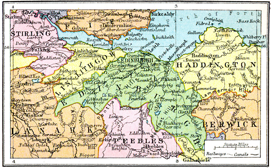
Description: A map of the district around Edinburgh, Scotland, from 1920. This map is color–coded to show the counties Linlithgow and Edinburgh, with portions of Stirling, Fife, Lanark, Peebles, Haddington, and Berwick. The map shows major cities and towns, railways, canals, the Forth Bridge, and the Firth of Forth.
Place Names: United Kingdom, Stirling, �Lin Lithgow, �Haddington, �Berwick, �Peebles, �Edinburgh, �Lanar
ISO Topic Categories: boundaries,
inlandWaters,
location,
oceans,
transportation
Keywords: District Round Edinburgh, physical, �political, �transportation, physical features, major political subdivisions, railroads,
water routes, boundaries,
inlandWaters,
location,
oceans,
transportation, Unknown, 1920
Source: , Asprey's Atlas of the World (London, England: Asprey and Co., Ltd., 1920) 35
Map Credit: Courtesy the private collection of Roy Winkelman |
|